Spain · The summary is refreshed every 15 minutes.
November 11
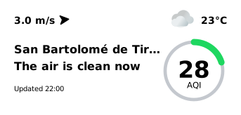
The air is clean now
Measured 20:00–21:47
San Bartolomé de Tirajana
23°C
Cloudy
28AQI
1013
hPa
Atmospheric pressure
86%
Humidity
San Bartolomé de Tirajana, November 10, 2026: daily mean PM2.5 3 µg/m³ (8 sensors), level “Low” — as in the Atmy Data Hub. Now (22:00 local time): 5.0 µg/m³. Open methodology and data in JSON: Methodology and data sources · JSON
Right now in San Bartolomé de Tirajana, PM2.5 averages 5.0 µg/m³ — “good” on the US EPA scale (approximate, from hourly readings). Mean of 8 sensors from Government stations, AirGradient, readings from 20:00–21:47 local time (20:00–21:47 UTC), summary prepared at 22:00 local time. Median: 3.9 µg/m³; range across sensors: 1.0–13.0 µg/m³.
In San Bartolomé de Tirajana the air is good 🟢 AQI 28. Higher than three hours ago. ☁️ +23 °C · No precipitation · Wind 3 m/s
In San Bartolomé de Tirajana the air is good right now (approximate, US EPA scale). From 09:00 to 22:00 local time the city mean PM2.5 rose from 3.1 to 5.0 µg/m³. The highest hour was 14:00 with 8.0 µg/m³.
High humidity (86%) possibly makes optical sensors read somewhat higher.
Weather now: cloudy, 23°C, wind 3 m/s, humidity 86%. No major change in the wind is expected in the coming hours.
Written automatically at 22:00 local time (22:00 UTC) from sensor measurements and the weather forecast. Values are approximate; hypotheses are marked.
3 m/s
Wind, W
0.1 mm
Precipitation today
San Bartolomé de Tirajana: air quality for the completed day
Metric: PM2.5, µg/m³ · Color scale: EPA AQI · November 10, 2026 · 00:00–24:00 UTC
3 µg/m³ Low
Daily mean PM2.5 on November 10, 2026 (00:00–24:00 UTC): 3 µg/m³ from 8 sensors that passed the quality check — the same value as in the Atmy Data Hub.
LowModerateElevatedHighVery highExtremely high
Air Quality in Spain for the Completed Day
Metric: PM2.5, µg/m³ · Color scale: EPA AQI · November 10, 2026 · 00:00–24:00 UTC
Highest current reading: 13.0 µg/m³ (Parque De San Juan-Telde (CCAA Islas Canarias)). Lowest: 1.0 µg/m³ (Agüimes (CCAA Islas Canarias)). The list shows every sensor, highest first.
Sensors in the summary by network: Government stations — 7 sensors, AirGradient — 1 sensor.
Atmy shows the networks’ readings after the Data Hub’s quality check: test devices and sensors that fail it are left out.
Spain: sensors in total
143
MataróSpain
21
Vitoria-GasteizSpain
18
A CoruñaSpain
15
Cities with the most sensors
All sensors on the map, by city as the map assigns them; the city’s values count only the sensors that pass the Data Hub’s quality check.
Air quality calendar: San Bartolomé de Tirajana
Daily mean PM2.5 of the city sensors, µg/m³
Click a day to see its date and value.
LowModerateElevatedHighVery highExtremely high
Widget for your site
An Atmy card with the air quality in San Bartolomé de Tirajana now: it is refreshed every 15 minutes and links to this page. Paste the code into your site.
What was the air quality in San Bartolomé de Tirajana over the last completed day?
Daily mean PM2.5 on November 10, 2026 (00:00–24:00 UTC): 3 µg/m³ from 8 sensors that passed the quality check — the same value as in the Atmy Data Hub.
What is the air quality in San Bartolomé de Tirajana right now?
Right now in San Bartolomé de Tirajana, PM2.5 averages 5.0 µg/m³ — “good” on the US EPA scale (approximate, from hourly readings). Mean of 8 sensors from Government stations, AirGradient, readings from 20:00–21:47 local time (20:00–21:47 UTC), summary prepared at 22:00 local time. Median: 3.9 µg/m³; range across sensors: 1.0–13.0 µg/m³.
Is it safe to be outdoors in San Bartolomé de Tirajana now?
The current level is “good” (US EPA scale, approximate). Air quality is satisfactory; no restrictions are recommended. This is the standard guidance of the scale, not medical advice.
Where in San Bartolomé de Tirajana is the air worse?
Highest current reading: 13.0 µg/m³ (Parque De San Juan-Telde (CCAA Islas Canarias)). Lowest: 1.0 µg/m³ (Agüimes (CCAA Islas Canarias)). The list shows every sensor, highest first.
Where do these data come from?
From Atmy sensors and connected public networks (citizen, experimental and government monitors), aggregated by Atmy. Values are approximate; see the methodology.
How often is this page updated?
The summary is rebuilt every 15 minutes from the latest reading of each sensor, each no older than one hour.
Data
Where do these data come from?
The daily value is the Data Hub’s: the mean of the city’s sensors that passed the nightly quality check, each with at least 12 valid hours, and only with sensors at four places 500 m apart; days are UTC.
“Now” uses the same sensors and rule: the mean of their latest readings, each at most 60 minutes old, shown only with sensors at four places 500 m apart reporting.
 November 11